GeoXsite GPR Solutions
3845 Winlake Crescent, V5A 2G6 Burnaby, BC
The company is fully insured and carries Commercial General Liability (CGL) Policy coverage.
GeoXSite
Completed Projects
Discover our recent GPR scanning projects across residential, commercial, and industrial sites. Each project showcases the accuracy, reliability, and efficiency of our services, utilizing 400 MHz and 1700 MHz antennas for detailed subsurface mapping and comprehensive risk assessment. See how we help contractors and engineers make informed decisions before cutting or coring.
GeoXSite
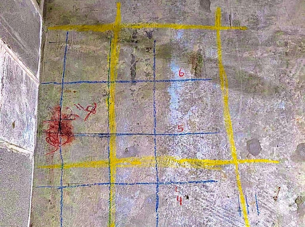
Concrete Scanning
At a residential project in North Vancouver, we conducted a thorough concrete scanning assessment to locate reinforcement bars and existing electrical lines within the concrete wall before core drilling. Using our advanced GPR technology, we delivered precise mapping of all embedded elements, ensuring that drilling operations could proceed safely.
This critical pre-drilling evaluation prevented potential hazards, including electrical shocks, power outages, equipment damage, fire risks, structural compromise, and costly repairs, protecting both the building’s integrity and the safety of the workers.
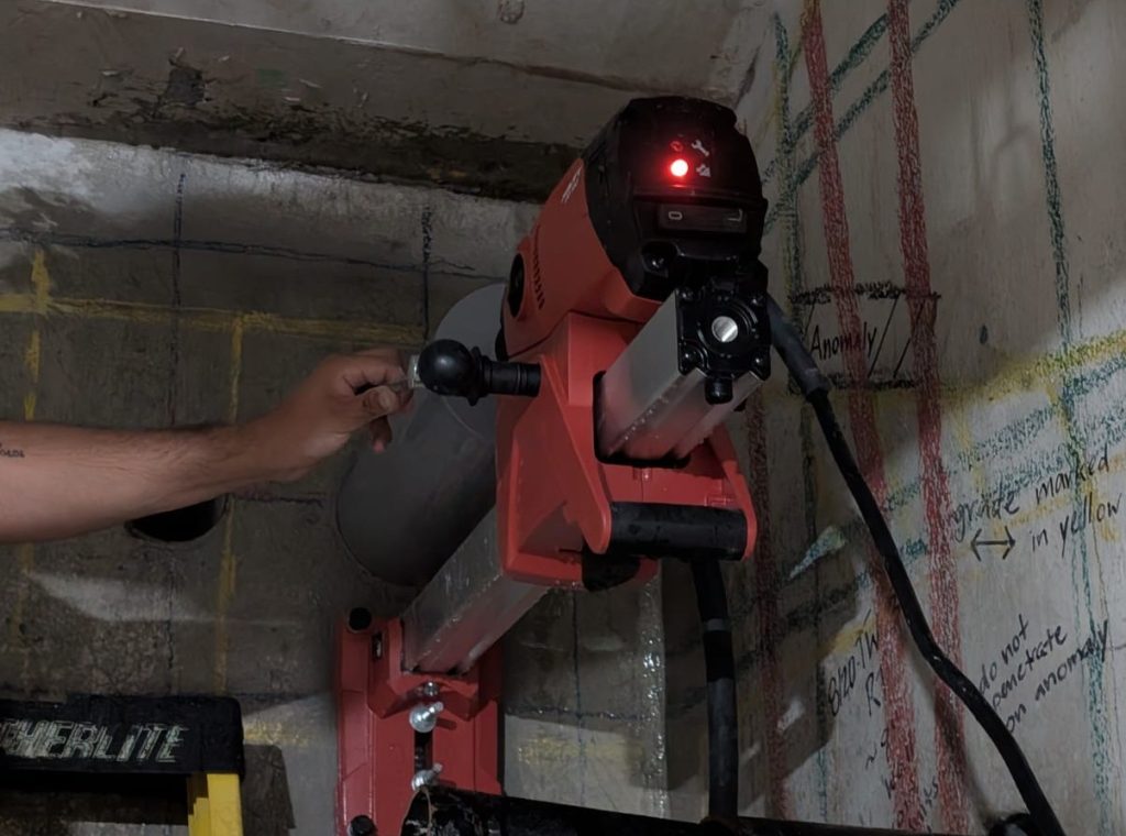
Successful Coring Operations
Following our comprehensive concrete scanning at the North Vancouver residential project, we carried out multiple precision core drilling operations with complete confidence. Thanks to our detailed GPR mapping, each drilling procedure was executed flawlessly, avoiding any complications.
The electrical conduits were installed exactly as planned, carefully navigating around all reinforcement bars and preserving the structural integrity of the walls. This project highlights how professional concrete scanning minimizes risks, prevents costly delays, and ensures successful results for both contractors and property owners.
GeoXSite
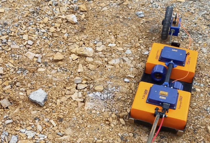
Infrastructure Inspection
We conducted GPR surveys to assess the condition of structural layers and locate buried utilities in a compacted gravel area, commonly encountered in infrastructure and road projects. Using our dual-frequency system (1700 MHz and 400 MHz), we accurately measured pavement thickness, identified voids and subsurface anomalies, and mapped embedded utilities—providing critical information for safe excavation, project planning, and risk prevention.
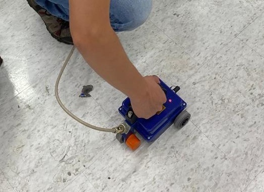
Utility Mapping
Our GPR system is designed for precise mapping of underground utilities, including metallic and non-metallic pipes, electrical conduits, and fiber optic cables. By providing real-time data and accurate localization, we help contractors and engineers plan, maintain, and execute infrastructure projects safely, preventing accidental utility strikes and minimizing costly delays during construction.
GeoXSite
Benefits of Choosing Us
Accuracy you can trust – Powered by cutting-edge GPR technology.
Safety first – Reduce risks to your team and structure.
Time & cost savings – Avoid delays, rework, and unnecessary repairs.
Local expertise – Serving with proven results.
GeoXSite
Contractors and engineers rely on our team because we:
Provide fast, reliable service tailored to project deadlines.
Deliver clear reporting with easy-to-understand results.
Offer flexible scheduling and emergency response when needed.
👉 Whether it’s a commercial building, residential renovation, or large-scale infrastructure project—we’ve got you covered.
 GeoXSite